Tuesday, November 23, 2010

Rays across the sky

The photo features an array of anticrepuscular-rays as observed in Kämpfelbach near Karsruhe, Germany on July 31, 2010. I will never forget this sight. Sunset was fast approaching, and I first noticed faint crepuscular-rays above the western horizon. Just after sundown, the rays could be seen stretching across the sky from west to east. On this photo montage, east is at left center and west at far right. This display lasted for about ten minutes. To add to the show, the rosy glow of Earth's rising shadow (belt of venus) and the shadow band itself were visible just above the eastern horizon (left center). These anticrepuscular and crepuscular rays were cast by clouds below the western horizon. Viewing perspective makes the rays seem to converge toward the horizon; though, they're actually parallel.

Photo details: Nikon D40x camera; 16 pictures in vertical-order; focus length 18 mm; F/3.5; 1/60 second exposure time; ISO 100.

lightning

The photo showing a classic cloud-to-ground lightning strike and a cloud-to-cloud bolt as well was taken at Kämpfelbach near Karlsruhe (southwest of germany) on August 22, 2010. Temperatures reached the mid 80s F (25-28°C) here by late afternoon shortly before a weather front and accompanying thunderstorm blasted through. The lightning was quite intense with this storm. I estimated 10-15 flashes per minute. Cloud-to-ground electrical discharges are typically observed when the base of the cloud is negatively charged and the ground is positively charged. On the other hand, cloud-to-cloud (inter-cloud and intra-cloud) lightning occurs most often when the top of the cloud is positively charged and the base negatively charged.

Photo details: Nikon D40x camera; F/9; 1/6 second exposure time; 18mm focus length; 100 ISO.

Dew bow

The photo above showing a sprightly dew bow was captured in a moist field crop at Kämpfelbach Germany on the night October 22, 2010. Since the photo was taken at night, the illuminating source is the almost full moon which is directly opposite of the dew bow at the anti-lunar point. The mechanics of a dew bow are similar to that of a rainbow. Moonlight is refracted and reflected within the dew drops. The city lights in the background are Karlsruhe.

Photo details: Canon EOS 450D camera; F/4; focal length 8 mm; ISO 100; exposure time 30 seconds; 3 photos stitched together.

Saturday, July 10, 2010

Discontinuous rainbow

This is an older observation (from last year). I made it at the Langmuir Laboratory for Atmospheric Research on a mountaintop in central New Mexico, USA at about 10,500 feet altitude above MSL.

The photos look to the east-northeast. The rainbow occurs in a storm that is receding and drifting to the east and has just passed Sawmill Canyon in the foreground. The mountain ridge on the photo is called Timber Ridge, and most of the heavier rainfall is on the other side of that. The much finer, mist-like droplets near the trailing end of the storm are still falling in the canyon and create a rainbow that has a smaller radius and is a little wider than an 'ordinary' bow that occurs in larger raindrops. The effect is very obvious but requires a fairly specific landscape setting to be seen.

The photos were taken on July 27, 2009 using a Nikon D700 camera. Times below are local time (MDT).

Photo 1: The effect is just beginning to occur. 18:37:50 pm, 36 mm focal length, ISO 800, 1/160 sec at f/6.3.

Photo 2: Effect strongest. 18:43:17 pm, 38 mm focal length, 800 ISO, 1/250 sec at f/8.

Photo 3: The rainbow in canyon is disappearing and still shows a discontinuity. Also note that the 'foot' of the rainbow beyond the canyon is not following the circle but appears to kink - i.e. the radius is getting larger at lower altitude - maybe due to drops coalescing and increasing in size as they fall? 18:45:11 pm, 48 mm focal length, 200 ISO, 1/125 sec at f/5.6.

All three photos have not been cropped, modified or enhanced in any way.

Wednesday, May 19, 2010

Bird Feather Iridescence

While taking a walk through the surroundings of my home on February 20, 2010, I took the most of the nice weather by taking some last winter photographs. At 10:09:27 CET, a small covey of about 15 siskins (Carduelis spinus) flew off an alder in front of me and passed me to the right. Seen from my position, they directly passed in front of the sun. I took some photographs with my Sony DSLR-A 700 and a Minolta lens 4/300 mm. The exposure time was 1/8000 second at an aperture of 32 and ISO 200.

Further settings of the camera were: Programme, serial photographs, automatic white balancing, and integral measurement stressed on the centre of the picture. In the original photograph, the sun is almost at the centre of the photograph. The precedent image of the series was exposed for about 1/4000 second at an aperture of 16.

That picture is brighter (a small part of the sun can be seen at the right rim of the photograph!) and the iridescence in the feathers looks rather faint.

Author: Rene Winter, Eschenbergen, Germany

Monday, April 19, 2010

Influences of the Mt. Eyjafjallajökull eruption on the atmosphere

In the morning of April 11, Mt. Eyjafjallajökull, a volcano which is covered by a glacier, erupted in the southwest of Iceland. Its cloud of ashes rises up to altitudes of 10 – 12 kms and has been shifted towards Central Europe by a northerly airstream since Thursday (animation).

The ash particles are slowly sinking downwards in the air, obstructing aviation in many places. In the atmosphere they dim the light (photos C. Hinz 1-2-3) and make Bishop´s Ring visible (photo P. Krämer), which is caused by light refraction on the aerosoles.

In high levels of the atmosphere, the particles act as additional nuclei for condensation, on which humidity (which under normal circumstances is not sufficient for cloud formation) freezes and forms ice crystals generating so-called “Invisible Cirrus Clouds”. Size and/or density of the ice crystals is in most cases not high enough to make the clouds visible, but their existence can be proved by the formation of faint halos such as sun pillars (photo Ina Rendtel), sundogs (photo Reinhard Nitze), or the 22°-halo (photo Brigitte Rauch).

There are still doubts regarding the appearance of the colourful twilight effects known from the eruption of Mt. Sarychev. Measurements with a Lidar effected by the Hohenpeissenberg Meteorological Observatory have shown that most of the aerosoles are at altitudes between 3.000 and 7.000 meters. A heavy rainshower should be enough to wash them out of the atmosphere and make the air clean again. An elevated concentration of sulphuric acid, which after the eruption of Mt. Sarychev formed several layers at different altitudes and caused beautiful purple light and afterglow effects, has not been measured at all. Probably the SO2 ejected by Mt. Eyjafjallajökull is chemically combined to water at the moment when the ash cloud is formed. The explosions, however, are generated by the contact of lava with ice, and every time a part of the glacier falls into the lava, there is plenty of water provided for such a reaction.

Authors: Claudia Hinz, Peter Krämer and Wolfgang Hamburg

Friday, April 16, 2010

Double Rainbow and reflected Rainbow

When I wanted to go to work in the morning of February 24, 2010, I noticed a colourful rainbow forming during a short local rainshower. At first the weather had been fine that morning, and ist was almost calm, but then some rain clouds came up from the southwest and started to cover the sky. The sun was shining brightly at that hour (about one hour after sunrise) and made the rainbow shine in especially bright colours. So I hurried to get my camera and started to make some photographs. While I was taking pictures, I was astonished to see a third bow forming, which intersected with the secondary bow. At the first moment I thought that there was something wrong with my eyes, but I could see it also when I looked at the pictures already taken on the camera display.

I was excited, although I could not make head or tail of it – I had never seen such a thing before. Later, as I searched the world wide web for an explanation, I learned that the phenomenon must have been caused by a reflection. But the reason for the phenomenon was still not clear, as there was nothing between me and the rainbow that could have reflected any light.
Only much later I could solve the mystery: The reflection was caused by the Hallwilersee (Lake Hallwil), which was at about 3 kms behind the position where I had taken the pictures that day. The lake cannot be seen from the place where I saw the rainbow, as there is a hill between the lake and that place. So I did not take this possibility into consideration at first. The position and elevation of the sun, my position towards the lake and the distance from the lake fitted perfectly that morning to form this rare phenomenon for a few moments.


Author: Matthias Frei, Dürrenäsch, Canton Aargau, Switzerland

Friday, April 02, 2010

Bishop's ring

Last Sunday, March 28, I went up on the Magdalena Mountains (in central New Mexico) to pick up two instruments from the laboratory there, and saw what would qualify as Bishop's ring around the sun for most part of the day. The mountain ridge lies at an altitude of about 10,500 feet above sea level. The sky was very clear and dry, and there was light wind at the time.

One of the photos I took is shown to the right. It was taken with a Nikon D700 with a 24-70/2.8 AF-S lens set at 24mm focal length and f/13 aperture.

To the eye the ring had a pronounced blue aureole with brown outer ring. I think the altitude of the observation rules out low-altitude aerosols being responsible. The central blueish aureole was relatively small; it was only a couple degrees in diameter. I estimate the radius of the outer brown ring to have been about 10 to 15 degrees.

Although the atmosphere was stable and quiet at the time I saw the ring, the southwest of the USA including New Mexico has had very strong winds and dust storms over the past week. In general, the spring months see many strong windstorms in this area. I believe the ring was caused by fine dust in the upper atmosphere and not from volcanic activity somewhere.

Tuesday, March 23, 2010

"Bubble Bow"

This picture actually shows just a few air bubbles frozen in a sheet of ice. But when watching it from a certain angle against the antisolar point, I discovered these strange colours. These can be expressed as a kind of “inverted rainbow”, as the circumstances under which it formed are exactly reversed to those of a normal rainbow. In a rainbow, the spherical object consists of water, but in this “bubble bow” the spherical object consists of air.

But there is a crucial difference: The ordinary main rainbow is based upon a double refraction of light and one inner reflection. But in case of this “bubble bow” the light is refracted four times: When it enters the ice, it gets refracted for the first time. The second time is when it enters the bubble. Then it is reflected once (or several times?) inside the bubble before it gets refracted a third time when leaving the bubble and entering the ice again. Finally, it gets refracted a fourth time when it leaves the ice. The “bubble bow” formed by this procedure has the same sequence of colours as a normal rainbow. But I do not know if it can ever be seen as a whole.

Photograph taken in Barsinghausen-Egestorf (Germany) on March 5, 2010, with a Canon EOS 1000d camera. More pictures are here.

Author: Reinhard Nitze, Barsinghausen, Germany

Monday, March 08, 2010

„Glorydescent Clouds“

In the morning of March 1st, 2010, I made my second observation of „glorydescent clouds“. These are fragments of a glory which change very much in diameter due to the different size of the droplets towards the rim of a short-lasting foehn cloud.
This makes the sequence of the colours look asymmetrically.
The stratocumulus lenticularis cloud did not even last for 5 minutes and caused a bright and very changeable iridescence or “glorydescence” during this short period of time. When the colours reached their maximum, up to 4 systems of rings were visible, with the 4th one appearing in the cloud behind the glory.
The pictures were taken at 8.05 CET / 8.06 CET / 8.07 CET.

Friday, February 26, 2010

Hair Ice

Hair ice (in German Haareis) is formed at dead wood by conditions of high humidity and temperatures near freezing point. Water in the pores expands below 4°C and freezes on the surface. In this way fine ice needles were created. (1-2-3)

I found it in the Black Forest (Schwarzwald) in southern Germany.

Author: Helga Schöps, Germany

Sunday, February 21, 2010

Halo Meeting of the “Arbeitskreis Meteore e.V. / FG Atmosphärische Erscheinungen der VdS e.V.“ at the Sudelfeld (Upper Bavaria), January 08 – 10, 2010

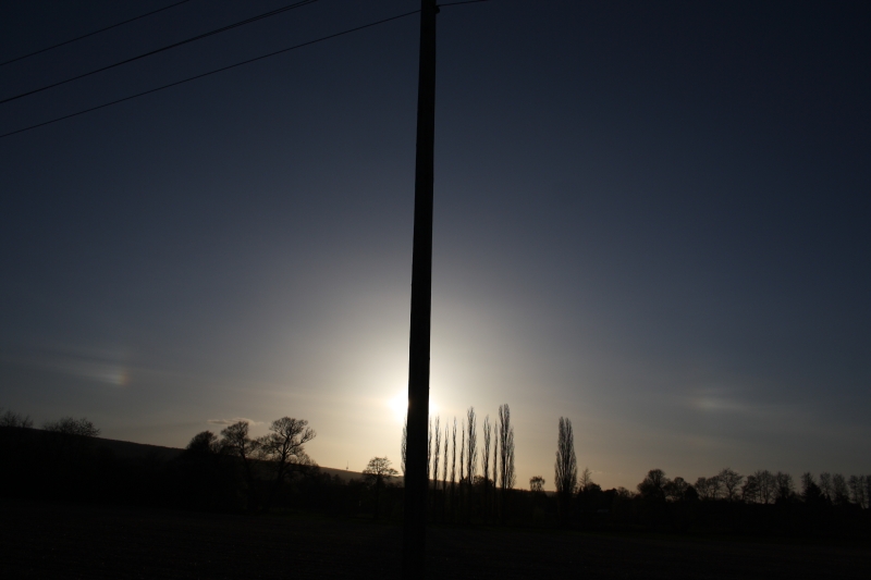
Winter halos in nearby ice crystals are quite a rare sighting in most parts of Germany. However, there are few special places where the chances for such displays are much higher, such as the Alps mountains. To benefit from this, 14 halo enthusiasts met at the Sudelfeld Youth hostel near Bayrischzell in the vicinity of the Wendelstein (1838 m) during the second weekend of January. Already on Thursday (January 07) a very impressive halo phenomenon at the sun could be observed by Reinhard Nitze. Unfortunately, throughout the meeting a complete cover of low-level clouds blocked the sun so that halo observations were restricted to artificial light sources during night time. The highest halo activity was noticed at late Friday evening, involving 
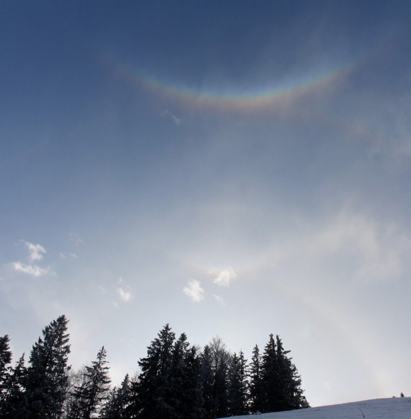
light pillars (or superlamps), upper and lower 22° tangent arcs (“champagne glasses”), parhelic circles (visible for only few seconds), and superparhelia (not photographed due to fleeting appearance). The phenomena showed remarkable dynamics, lasting for about 10 minutes and being followed by intervals of 30-60 minutes without halos. The influence of snow blowers was discussed as well, since there were some of them running the whole night, approximately 500 m apart from the observation place.


Photo: Claudia Hinz


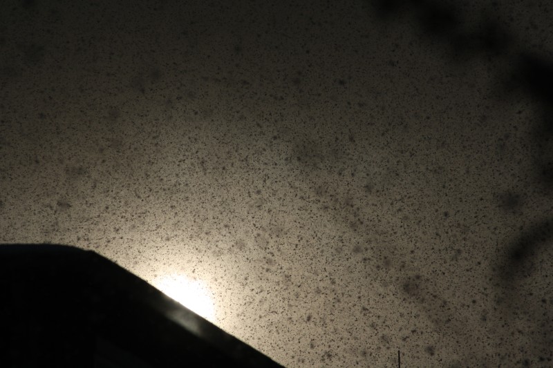
During the second evening only weak light pillars were seen for short times, eventually being replaced by fog bows due to rising temperatures and the transition from ice crystal to water droplet fog. Great fun were the shadow plays using a floodlight in the back of the people what finally led to photos of the “
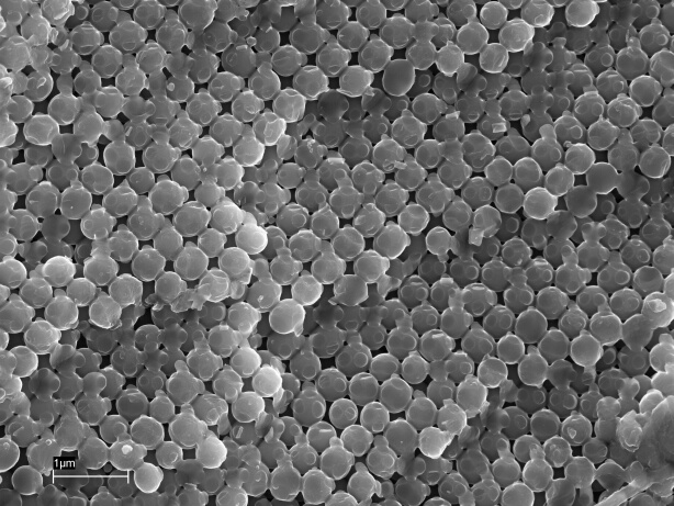
Sudelfeld monster”.Apart from the actual observations, the participants joined a workshop program containing slideshows from Michael Großmann, Claudia Hinz, Reinhard Nitze, and Andreas Zeiske as well as talks dedicated to special topics such as halo image stacking by Georg Dittié, high dynamic range image processing by Claudia Hinz, high precision measurements of the moon’s opposition effect by Elmar Schmidt, microphotography of snow and ice crystals by Reinhard Nitze, and artificial dew bows as well as stereo photography by Alexander Haußmann. The following experimental demonstration of glass bead bows in divergent light was received with great interest and triggered a high amount of photographic activity. Furthermore, an excursion to the nearby Tatzlwurm waterfall (named after some kind of dragon) was organized at Saturday afternoon and revealed a great winter landscape containing a large number of worthwhile photo subjects.


Photo: Udo Hennig


More pictures are here.

Author: Alexander Haußmann, Hörlitz, Germany


Monday, February 01, 2010

Colours inside a cracked piece of ice

After some very cold days in Heréd (Northern Hungary) Karoly Viczian went out to the garden to break the ice in a rainwater collecting barrel. On a small piece of ice he cut out from the barrel he could see some very vivid colours - it reminds me to the diffraction colours of an opal gemstone. So maybe the coloures were produced by some microscopic bubbles inside the ice just the same way as they form in the gemstone that has small spherical structure . But Károly said he had noticed the colours after breaking up the ice, so it seems that the small cracks inside might have produced them with the help of birefringence.
As Károly told me the ice was the outcome of multiple freezing and melting periods, so it might also have separate layers inside. He has more pictures of the same piece of ice. The water was simple rainwater, only some fallen walnut leaves were at the bottom of the barrel, nothing was put in it willingly.
What is the correct explanation of this phenomena?

Sunday, January 03, 2010

Iridescent Fireworks Smoke

Like everywhere around the world, New Years Day was also welcomed with fireworks around Mt. Wendelstein. It is always a special highlight to watch the fireworks from the top of the mountain at 1838 meters above sea level. In the Leitzach Valley, about 1000 meters lower, there was a fireworks display.
Even when watching it with the naked eye, the smoke and fog of the fireworks seemed to show iridescent colours. The photographs
(photo) show the iridescence more obviously. It was probably caused by the condensation nuclei from the fireworks smoke, on which small droplets condensated. As short time before an area of precipitation had passed, air humidity was still very high.
Additionally, the fireworks caused a thin layer of fog over almost the whole alpine foothills area (photo), and the big city of Munich with more than a million inhabitants, was covered by a thick layer of clouds (photo).


Similar things were reported by other observers. In Bochum, Peter Krämer observed that light graupel turned into snow during the fireworks, leaving about a centimetre of snow. On the weather radar it could be seen that a precipitation area formed right over the Ruhr area just after midnight.

Two years ago, thin fog with visibilities around 300 meters thickended after the New Years Fireworks, forming a dense layer of fog with visibilities which were less than 10 meters in some places.

Northwestern Germany Diamond Dust Sun Pillar

Diamond dust halos are normally observed in northern regions of Europe, or in the mountains where temperatures in winter often drop sufficiently for the formation of ice crystals near the ground.

On December 19, 2009, there were several reports of diamond dust from the lower parts of northwestern and western Germany, which formed widespread sun pillars.
With temperatures of about -14°C, I also witnessed an upper and lower sun pillar in Bochum, Germany.
The lower sun pillar was visible in front of trees and even the snow-covered ground, as the picture taken at about 9 hours CET shows with the sun hidden behind a sign-board.
I could also see the ice crystals glittering in the air, making the pillar appear three-dimensional, as if a ray of light extended from the sun right up to my eyes.
The upper part of the sun pillar was visible for about half an hour, while the lower part and the glittering of the ice crystals stayed for about 3 hours until noon.

Author: Peter Krämer, Bochum